Advances in inexpensive control systems and electronic devices have promoted the development of small Unmanned Aerial Vehicles (UAVs) in a wide range of applications. Their unique ability to fly in hovering, highly maneuvering, with vertical take-off and landing, makes UAVs extremely attractive. The use of small drones opens new possibilities in several application fields and this could have an enormous socioeconomic impact shortly. For example, drones equipped with cameras can resolve the problem of the images taken by satellites (which are often expensive, weather-dependent, and in low-resolution) or car-based images (which are limited to human-level perspectives and the availability of accessible roads). In addition, farmers can check the quality of crop growth by using cameras mounted on specific UAVs. These particular drones will also enable construction companies to verify work advancement in real time. For mining companies, interest focuses on the possibility of obtaining accurate volumetric data, leading to lower risks for their employers. Furthermore, humanitarian organizations will be able to evaluate and adapt aid efforts for refugee camps, while medical supplies can be delivered quickly by rescue organizations where necessary. By using UAVs for transportation, developing countries (i.e. countries without appropriate road networks) could deliver goods simply. Inspection drones, vehicles able to fly in confined space, can be used by fire-fighting and emergency units to assess danger faster and safely, or by logistic companies to detect damages to both inner and outer shells of ships, or by road maintenance companies to measure deterioration in bridges or tunnels. Security agencies will be able to improve building safety by monitoring even the areas outside the camera’s range. Drones will enable disaster mitigation agencies to inspect partially collapsed buildings in the event of obstacles for terrestrial robots. Teams operating with drone swarms will enable longer missions by allowing a single drone to leave the swarm for a short time to replace the battery.
Below are the main fields in which drones have been developed thanks to the collaboration between NHOE and Siralab Robotics s.r.l.
Surveillance (ISR):
Drones have become invaluable assets for Intelligence, Surveillance, and Reconnaissance (ISR) operations, particularly in military, national security, and civilian applications such as environmental monitoring. Their ability to fly at variable altitudes and access hard-to-reach areas enables them to provide detailed, real-time information on a wide range of targets. Equipped with advanced sensors like high-resolution cameras, thermal sensors, radar, and Electronic Signals Intelligence (SIGINT) systems, ISR drones can collect critical data for border surveillance, traffic monitoring, detection of suspicious activities, and support in search and rescue operations.
Aerophotogrammetric Mapping:
Aerophotogrammetry is a technique used to create detailed maps and three-dimensional models of terrain using aerial imagery. Drones have become a popular choice for collecting aerophotogrammetric data due to their flexibility, low cost, and adaptability to various environments. Equipped with high-resolution cameras and precise positioning systems like GPS, drones can fly over specific areas and capture high-definition aerial imagery, which is subsequently processed to create detailed terrain maps, Digital Terrain Models (DTM), and Digital Surface Models (DSM). These data are used for urban planning, natural resource management, emergency planning, and many other engineering and geospatial applications.
Multispectral Mapping:
Multispectral mapping involves capturing images in different bands of the electromagnetic spectrum, beyond visible light. Drones can be equipped with multispectral sensors that allow them to collect data in bands such as Near-Infrared (NIR) and Thermal Infrared (TIR). These multispectral data are used to monitor crop health, analyze vegetation, detect the presence of pollutants, and assess water and soil quality. Multispectral mapping provides detailed information that can be used to optimize natural resource management, improve precision agriculture, and support environmental planning.
Radiometric Mapping:
Radiometric mapping involves measuring the electromagnetic radiation emitted or reflected by objects on the Earth’s surface. Drones can be equipped with radiometric sensors that allow them to collect data on solar radiation, surface reflectance, and other radiometric properties of terrain and structures. This data is used to analyze the chemical composition of the soil, identify specific materials or substances, assess pollution levels, and monitor environmental changes over time. Radiometric mapping provides crucial information for natural resource management, environmental assessment, and land planning.
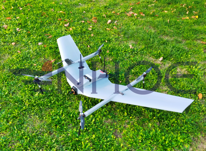
Here are a few examples of UAVs appropriate for these purposes:
SR-X2 XENON